

A wind project on Yinka Dene territory
Current condition studies are underway to explore the natural, cultural, and community values of the Ni Ti Mountain Wind Project area. By combining desktop research, field assessments, and close collaboration with Stellat’en First Nation, Nadleh Whut’en, and local communities, the project team is creating a project that is designed, constructed, and operated in a manner that respects the land, wildlife, and cultural heritage while minimizing potential impacts.
Existing Conditions
Status
Preliminary desktop and field studies have been conducted to gauge existing conditions of the Project Area. The following information gives an overview of study findings (ie. key results) so far.
Project Area
The definition of “Project Area” acts as an investigative buffer located around all project infrastructure. By having this buffer, studies are able to gain a more in-depth understanding of the landscape that the project is situated within, even if project infrastructure (turbines, collector lines, transmission lines and roads) itself is not sited on every part of the “Project Area”. “Project Footprint” describes land where current designs dictate project infrastructure will be sited.
Understanding the existing conditions of the landscape is a key part of avoiding, minimizing, and mitigating potential project effects. The Project Area is characterized by recent forest disturbance, with extensive logging over several decades and forest fires contributing to a mosaic of clearcuts and lower-age forests. Terrain in the Project Area is generally hilly, not mountainous, and consists of well to moderately well drained soils. Winters tend to be very cold and snowy, while summers are warm and wet. The closest existing communities to the Project are the Stellat’en community of Stellaquo and the Village of Fraser Lake.
Studies
In this section, the purpose, methodology, and status of several project studies will be described in detail. Please note that the results are considered preliminary, meaning that the studies are still ongoing and in some cases the findings are still in the process of being fully reviewed and/or confirmed
Goal:
To identify known archeological and heritage sites within the project area so that interactions with these sites are avoided to the extent practicable.
To develop a chance-find procedure that mitigates potential project impacts on unknown sites.
Preliminary Results:
Currently, 20 previously recorded archaeological and heritage sites have been identified within the project area as part of the desktop assessment. This initial assessment has been informing further archaeological analysis that is ongoing. A field investigation of high potential locations is underway to put forward recommendations to be incorporated into project design and mitigation measures to avoid or minimize impacts to any new or previously recorded archaeological sites.
Methodology: An Archeological Overview Assessment (AOA) has been conducted. An AOA is a desktop study using existing information and experiential knowledge to identify known archaeological and cultural heritage concerns. Some preliminary field work to verify AOA findings has been completed. The field crew involved in the AOA included a team of archaeologists from ARCHER Cultural Resource Management and field monitors from Stellat’en First Nation and Nadleh Whut’en. An Archaeological Impact Assessment (AIA) is now underway to field-validate areas of high potential, previously identified during the AOA, to aid in identifying potential archaeological sites and preparing site specific recommendations.
Goal: A traditional use study is conducted to cultivate understanding and respect for the ways in which First Nations have traditionally and currently use lands, waters, plants, animals, and other resources. This knowledge is used to avoid (when possible) and otherwise mitigate any potential impacts of the project on the land so that future generations can continue to practice land-based activities.
Preliminary Results:
Stellat’en members travel to Ni Ti Mountain for a variety of reasons including to harvest berries, hunt for moose, spend time out on the land, enjoy a sense of peace and quiet, and to observe and know the land. Several valued plant and animal species such as huckleberries, blueberries, medicinal plants (Devil’s club, labrador tea, juniper), lynx, cougar, grouse, grizzly bear, moose, and deer known to inhabit the Ni Ti Mountain area have been identified in this study. As well, the impacts of recent wildfire on the northern part of Ni Ti Mountain on important habitat and hunting areas was highlighted.
Project infrastructure can have a range of potential impacts on cultural land use including but not limited to plant and wildlife habitat loss and fragmentation, visual effects and impacts of noise, impacts on valued wildlife species (displacement, stress, behavioural changes), impacts to watercourses, wetlands, riparian areas due to land clearing (erosion and sedimentation), and changes to land access.
Identified offsetting and mitigation measures resulting from the Indigenous Knowledge and Land Use study include prioritizing habitat restoration, undertaking chemical-free vegetation management, preserving critical habitats, managing access, and fostering community involvement and cultural continuity through community-led monitoring, knowledge-sharing initiatives, and stewardship programs. Further collaboration between Stellat’en and Nadleh leadership, Innergex and the wider Stellat’en and Nadleh communities, as part of the Yinka Dene Ecological and Cultural Rights Based Assessment, will lead how such measures are developed and implemented.
Methodology: The Firelight Group conducted an Indigenous Knowledge and Land Use Study drawing on previously collected Stellat’en data and study reports. This study helps inform continued conversations regarding avoidance, mitigation and offsetting measures.
Further conversations have been facilitated including community workshops and site visits with Stellat’en First Nation that have identified several valued ecological features. This feedback was incorporated into project design and has resulted in modifying the transmission line route to avoid and/ or minimize project-related impacts.
Work is currently underway to complete a similar Indigenous Knowledge and land Use Study for Nadleh Whut’en as well as accompanied engagement with Nadleh members to gather information for the study.
Goal: To assess stream crossing associated with proposed new roads or road extensions, measure water quality.
Preliminary Results:
In the desktop study, several fish bearing watercourses were identified within the Project Area including Stellako, Cabin, Robertson, Smith and Targe creeks. Several species of fish inhabit these waters including Chinook and Sockeye salmon.
Field work completed to date has assessed 20 potential stream crossings (including the potential transmission line crossing over the Stellako River). Initial findings include:
- Many streams had no visible channel, others had intermittent flow and wetted areas
- Fish sampling was conducted at 2 locations with sufficient water depth and stream flow conditions
- 19 cutthroat trout were captured by electrofishing at one of the locations. No fish were captured at the other location.
- Dense and mixed riparian areas were observed at the Stellako River crossings.
Methodology: Desktop studies reviewing publicly available information identified watercourses that intersect the Project Area.
Fish and Aquatic Field Assessments were conducted at stream crossings by completing ‘habitat site cards’ (a standardized method to record stream habitat characteristics). Fish sampling was conducted at sites where sufficient water depth and stream flow conditions were present.
Goal:
Birds – To quantify bird use of the project area.
Bats – To investigate the presence of bat roost habitat and bat use of the project area.
Preliminary Results:
Birds – Overall, the diversity of observed bird species composition is as expected for the region. No migratory raptors (a bio-indicator of habitat health) were observed and 2 SARA-listed species were detected, namely the Common Nighthawk and Olive-sided Flycatcher.
Bats – Areas with bat roost potential were identified during the field surveys. The acoustic recording units (ARU) data collection period was completed in October 2025 and the data collected is in the process of being analyzed.
Methodology:
Birds – Field studies were conducted to identify species and nesting grounds present in the Project Area using point count surveys, stick nest and cavity tree surveys, raptor migration monitoring, as well as acoustic recording units and song meters that were installed to identify, fixed survey points chosen to provide spatial coverage of the project area.
Bats – Field studies were conducted to investigate the presence of bat roosting habitat. Acoustic recording units were installed for the duration of active bat season (March-October).
Goal:
Wildlife – To determine instances of mammals, invertebrates, reptiles in the project area.
Vegetation & Ecosystems – To identify sensitive ecosystems and biodiverse areas intersected by the Project.
Preliminary Results:
Wildlife – Species that have been identified as species of concern and/or cultural importance include western toad, bald eagle, olive sided flycatcher, and little brown myotis (commonly referred to as “little brown bat). This has informed the preliminary design of the Project. No critical habitat for species at risk is listed near the project area.
Other wildlife observations include amphibians such as western toad, Columbia spotted frog, wood frog and long toed salamander (identified in ditch ponds along roads), bears, American beaver, elk, snowshoe hare, coyote, North American porcupine, Canada Lynx, moose, grey wolf, and red squirrel.
Vegetation & Ecosystems – Desktop studies have revealed that there are 12 ecosystems at risk present which accounts for 1.5% of the Project Area. Wetlands and Old Growth Forest account for 4% and 12% of the project area respectively. There are no known industrial or contaminated sites within the project area. Some ancient forest deferral areas intersect with the Project footprint and will be field confirmed during studies. No at-risk plant species or old growth management areas identified in the project area. Several species that were highlighted by Stellat’en First Nation were observed including black huckleberry, juniper, prickly rose, red raspberry, saskatoon, and soopolallie.
Habitat quality varies throughout the project area from intensively managed forest lands to high quality wetlands. There are overlaps between project area and one wildlife management area as well as one ungulate winter range area. The Project footprint intentionally avoids valley bottoms, riparian zones, and mature forests.
Methodology:
Wildlife –
Desktop and field studies to identify areas of importance to conservation or wildlife management that either intersect with the Project area or are in the vicinity of the Project. Input received from First Nations identifying biodiversity management areas. These surveys are focussed on wildlife habitat.
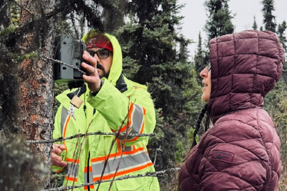
Wildlife cameras continue to be used to help collect data about wildlife presence.
Vegetation & Ecosystems –
Desktop and field studies to identify sensitive ecosystems, vegetation species at risk. Input received from First Nations to identify culturally important plant species (berry species in particular) and biodiversity management areas intersecting the project.
Goal: To understand ground/subsurface conditions to ensure that infrastructure is designed, built, and managed safely and effectively.
Preliminary Results: Processing the data collected from geotechnical investigations is ongoing and will directly inform the projects final layout design.
Methodology: A field investigation including 16 test pits, 5 boreholes, and the installation of 3 groundwater monitoring wells.
Goal:
- To identify potential project interactions with existing land use and mitigate any impacts that the project may have.
- To identify and consequently mitigate any potential community impacts (including noise, visual, traffic, and shadow flicker)
Preliminary Results:
An evaluation of socio-economic impacts (housing, use of local resources, and vulnerable populations), consultation, community engagement, evaluation of quality-of-life impacts (noise, light, traffic, dust and access management, and shadow flicker) and application requirements will be undertaken in 2026.
As part of the Energy Resource Activities Act permit application to the BC Energy Regulator, we are developing assessment reports that consider how the Project may affect environmental, social, and economic values during construction and over its lifetime. The purpose of these assessments is to identify potential effects and to collaboratively develop mitigation measures that can be integrated into Project design, construction methods, and operational practices to avoid, minimize, or manage those effects. As we begin these assessments, we will be reaching out to government (federal, provincial, local), First Nations, Rights Holders and Private Landowners to help us identify key values you consider important and how you expect Ni Ti Power to study and consider those values. Your input will help to guide the assessment and its eventual recommendations – invitations to participate has been sent out in Q1 2025 Community and Social Well-Being: Health – As a result of initial desktop studies, the Project is not expected to negatively impact human health, given the distance of more than 7 km from the nearest residences and the implementation of mitigation measures for emissions and noise during construction. The operational phase will not generate harmful emissions, and any concerns related to wind turbine noise or shadow flicker are being addressed using best practices and established health guidance. Scientific evidence does not indicate a direct link between wind turbine projects and adverse health effects.
Community Wellbeing: Jobs – As a result of initial desktop studies, employment in the region traditionally centered on manufacturing, forestry, education, and health care. However, recent economic changes including the 2024 closure of the Fraser Lake Sawmill and the earlier suspension of operations at the Endako Mine have significantly affected local employment. Meanwhile, the nearby Blackwater Gold Project is under operation as well as expansion and may contribute to regional economic activity.
Community Engagement: Stakeholders with tenure overlaps with the project have been identified and contacted to discuss the Project. Consultation with other land users is ongoing. A public open house was hosted in the Village of Fraser Lake on January 23, 2026. Engagement and consultation will continue throughout the life of the project. Check out our News section.
Visual Assessments: Photos from selected viewpoints in the project vicinity were collected. First Nations reserve lands, parks, recreation sites and private land parcels were used as locations for potential viewpoints. Next steps and part of ongoing work include creating visual simulations and public engagement to gauge feedback on the potential visual impacts of the project on the landscape.
Noise & Shadow Flicker Assessment: Noise impact assessment and shadow flicker assessment are required to be submitted as part of the permitting application if there is a receptor (building regularly occupied by persons) within 1.5 km of potential noise sources associated with the project and its operating area. Initial desktop assessment and modeling have not identified potential noise or shadow flicker receptors. The continuation of noise assessments is a part of the ongoing work for the Ni Ti Mountain Wind Project.
Methodology:
Initial desktop screenings have been conducted to identify potential project interactions with existing land users (e.g. forestry, agriculture, mining, guiding, and trapping tenure holders, informal land use, etc.) will continue to be investigated through ongoing community engagement and consultation.
Individual studies will be conducted to evaluate the potential impacts of noise, visuals, traffic, and shallow flicker.
For visual assessments a zone of theoretical visibility map is created followed by creating theoretical visualizations of what the landscape would look like with a wind facility sited at its proposed location. Community engagement is a key part of determining viewpoints and gauging feedback on the final visualizations.
For noise assessments, the project assesses whether there are receptors within 1.5 km of noise emitting infrastructure, then the estimate noise levels of project infrastructure are modelled to determine compliance with regulatory noise thresholds.
For shadow flicker assessments, the project also assesses whether there are receptors (building regularly occupied by persons) within 1.5km of the proposed operating area. Following receptor identification, wind facility design must ensure that shadow flicker at identified receptors is limited to 30min/day and 30 hours/year.